
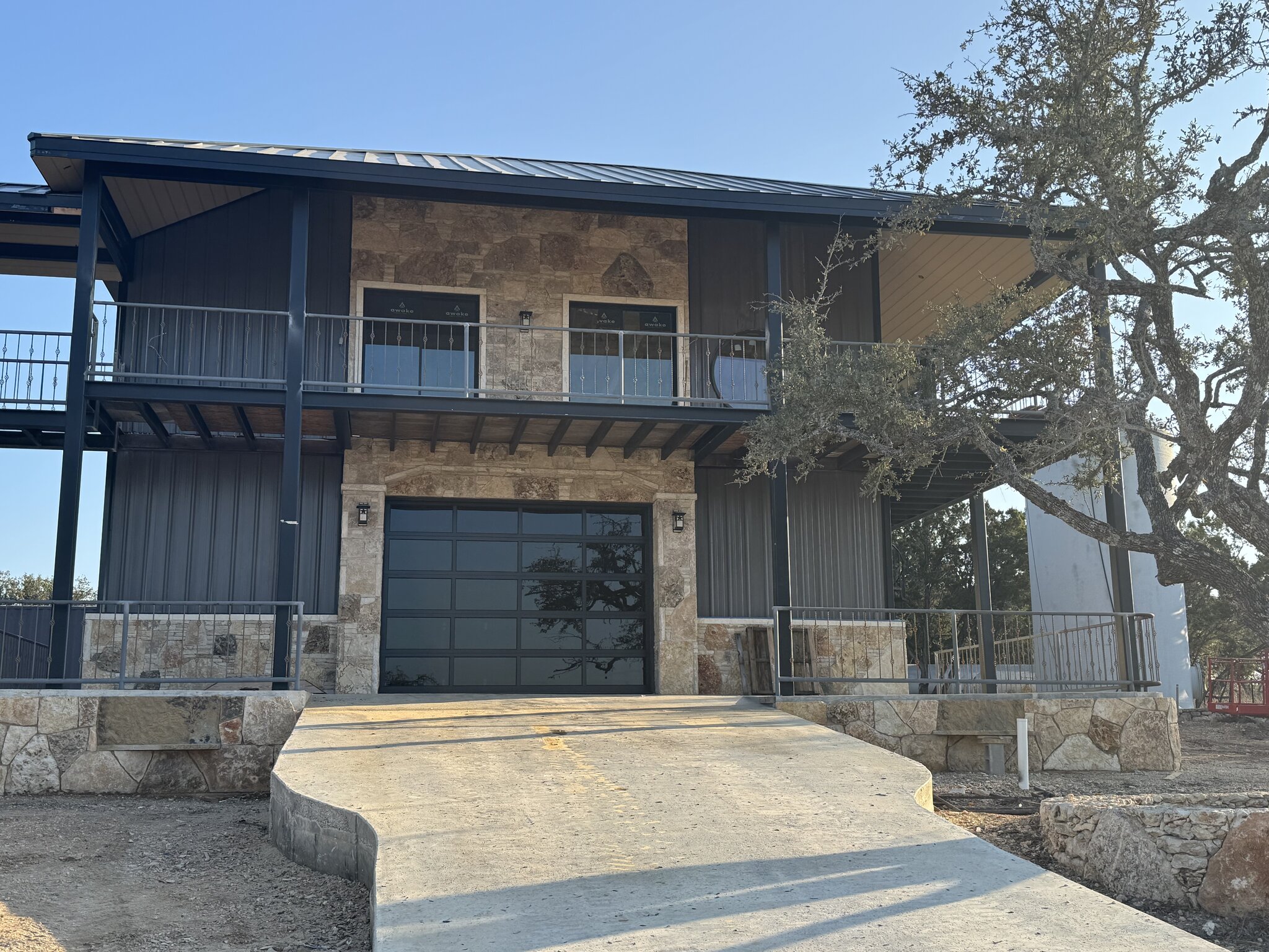
Construction staking puts your approved building plan on the actual dirt. On a steep Hill Country lot, it means marking exactly where the foundation, corners, and elevations sit so the build lands square, drains right, and stays inside your property lines. It is construction layout, not licensed land surveying. A licensed surveyor sets the boundaries first; Iron C Construction builds inside them.
What construction staking actually is on a sloped lot
Construction staking is the process of transferring the lines on your drawings to physical marks on the ground. Stakes, hubs, and offset points tell the crew where the foundation goes, how deep to cut, and how high to build. On a flat lot that is straightforward. On a slope, every inch of grade change moves the numbers, so the layout has to account for elevation, not just position.
The surveying profession itself draws this line. The National Society of Professional Surveyors publishes separate Model Standards for Construction Layout, distinct from its boundary-survey standards. In plain terms, locating a property corner is one job. Staking an approved design inside those corners is a different job. We do the second one.
Why does that distinction matter so much here? Because the cost of getting placement wrong on a steep lot is high. A foundation set a foot off, or built at the wrong elevation, can wreck drainage, blow your setbacks, or force expensive rework once the slab is poured.
How GPS and robotic total stations place the build accurately
Modern layout leans on two tools: GPS and robotic total stations. According to NOAA’s National Geodetic Survey, single-base real-time GNSS positioning produces three-dimensional positions with relative accuracy on the order of a centimeter per component. That is tight enough to place a foundation corner with confidence, even on rough terrain.
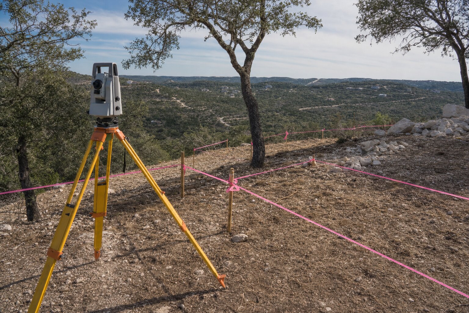
GPS works because it ties into a known framework. The National Spatial Reference System is the official US reference for latitude, longitude, height, scale, and gravity, anchored by control points and continuously operating reference stations. We tie our layout to that framework so the marks on your lot match the coordinates on your plans.
Where the tree canopy or terrain blocks a clean satellite signal, we switch to a robotic total station. These instruments are typically rated by manufacturers around 1 to 5 seconds of angular accuracy with roughly millimeter-level distance measurement, run by one operator with automatic tracking, per industry equipment overviews. Treat that as typical instrument precision, not a fixed standard. Between GPS in the open and a total station under cover, we keep construction staking accurate across the whole site.
Why a benchmark and elevation control matter on a slope
On a steep lot, vertical control is as important as horizontal. We work from a site benchmark tied to the official US vertical datum, NAVD 88, which the National Geodetic Survey maintains through roughly 450,000 benchmarks nationwide. That benchmark is the fixed elevation reference everything else gets measured from.
Once the benchmark is set, we can stake finished-floor elevation, pad height, and cut-and-fill depths with real numbers instead of guesses. On a slope, that is what keeps the house from sitting too low on the downhill side or perched too high on the uphill side. It also tells the excavator exactly how much dirt to move before any concrete shows up.
Here in the Hill Country, that often means cutting into limestone or caliche on the high side and building up engineered fill on the low side. Getting those depths right early saves money. Discovering a grade problem after the forms are set never does.
Cut, fill, drainage, and setbacks
Drainage drives a lot of decisions on a sloped build. The International Residential Code, in Section R401.3, requires lots to be graded so water drains away from the foundation, with the grade falling at least 6 inches within the first 10 feet. Where slope or barriers make that impossible, the code calls for drains or swales instead.
On a steep lot, meeting that rule shapes where the build can sit. We stake the cut-and-fill lines so the finished grade carries water away on every side, then mark swales or drain runs where the natural fall fights us. Place the foundation a few feet uphill or down, and the whole drainage picture changes.
Setbacks are the other constraint. Your required distances from the property line come from the plat, county zoning, or your subdivision covenants. We stake the structure to honor those distances. But confirming exactly where your property line runs is a boundary determination, and that belongs to a licensed surveyor, not to us.
Construction layout versus licensed land surveying
This is the line we never blur. Texas law, in Occupations Code Section 1071.002, defines professional surveying to include locating real-property boundaries, and the broader Chapter 1071 reserves that work to a Registered Professional Land Surveyor licensed under the state board. Determining where your property corners and lines sit is surveying.
Iron C Construction does not perform that work, and we would not tell you we do. A licensed surveyor establishes your boundaries and corners. We take the approved design and stake it accurately inside those established lines. That order matters. You want the property pinned by a licensed professional before we lay out a single foundation corner.
Being honest about that split protects you. It means your boundaries carry the authority of a licensed surveyor, and your build carries the precision of careful construction layout. Robert Castro founded Iron C Construction in Wimberley in 2020, and we have placed plenty of builds on steep Hays County lots by respecting exactly this line.
Putting it together on a real Hill Country build
On a typical sloped lot, the sequence is steady. A licensed surveyor sets the boundary and corners. We tie a site benchmark to NAVD 88, then use GPS and a robotic total station to stake the foundation, the cut-and-fill grades, and the drainage so the finished site sheds water per the code. Every mark traces back to your approved plans and the national reference framework.
Layout is also not a one-time event. We stake at stages: rough grading first, then the foundation forms, then key points as the structure goes up, checking each against the same control points. On a slope, that repetition catches small drifts before they compound. A stake that was right at grading can get knocked loose by equipment, so verifying as we go is part of keeping the build true from the first cut to the final wall.
Done right, the slope stops being a problem and becomes part of the design. The house sits where it should, the water goes where it should, and nobody is chasing a placement mistake after the slab is down. That is the whole point of careful layout on difficult ground.
If you are planning a build on a steep or tricky lot in the Hill Country, talk to Iron C Construction about construction staking and layout. We will walk you through how we place the build accurately, where the licensed survey fits in, and how we keep your foundation, drainage, and setbacks right from the first stake.