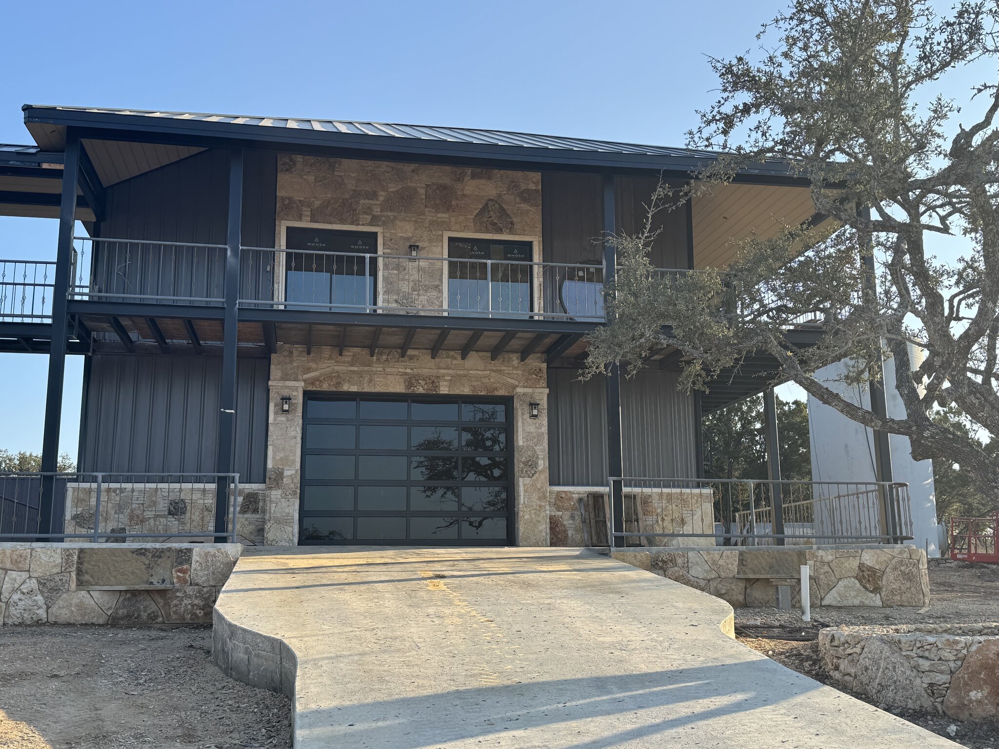
Yes, you can build a house in most of the mapped floodplain around Wimberley, but not just anywhere and not at ground level. Outside the city limits, the Hays County Development Regulations set a clear floor height. A new home’s lowest floor, including its machinery and electrical equipment, has to sit at least 2 feet above the base flood elevation. The regulatory floodway, the channel and nearby land the Blanco River or Cypress Creek needs to carry a flood, is off limits unless an engineering study shows the work will not raise flood levels.
Inside Wimberley’s city limits, the City of Wimberley runs its own floodplain permit. Either way, the flood map decides where the house can go and how high the floor has to be, so it belongs at the start of the design, not after the plans are drawn.
Who issues the floodplain permit in Wimberley
The first question is jurisdiction. A lot near Wimberley may sit inside the city limits or out in unincorporated Hays County, and that changes who reviews your plans. Hays County says all development in the unincorporated county requires a permit, inside or outside the floodplain. Its January 2026 fee schedule lists a $100 permit for development outside the Special Flood Hazard Area and a $300 permit for a habitable structure inside it. Building in the floodplain without a permit carries a $600 penalty fee, and a base flood elevation request costs $30.
The county sorts these into classes. A Class A permit is an exemption certificate for land with no mapped hazard area. A Class B permit covers a home or other habitable building inside the hazard area, and any variance on a Class B permit has to go to the Commissioners Court. Class C covers non-habitable structures and other development in the floodplain, such as a barn or a shed.
Inside the city, the City of Wimberley’s Planning and Development office handles floodplain development. Its forms page lists a floodplain development permit, which costs $100 for residential work and $150 for commercial, and a floodplain determination request, which costs $50. Both ask for a site plan and a location map. Woodcreek is a separate city, so a lot there has its own review.
What do FEMA flood zones mean for a Wimberley lot?
FEMA’s flood maps sort land into zones by risk, and the letter on your lot sets most of the rules that follow. The Hays County floodplain page breaks them down this way.
| Flood zone | Risk level | What it means for a home site |
|---|---|---|
| A, AE, AH, AO, AR, A99 | High | A 1 percent chance of flooding in any year, or a 26 percent chance over a 30-year mortgage. These are the Special Flood Hazard Areas, where flood insurance is mandatory for most mortgage holders. |
| Shaded X | Moderate | Outside the high risk flood zones. The risk is reduced, not removed. |
| X | Lower | An area of overall lower flood risk. |
| D | Undetermined | Possible flood hazards that have not been studied. |
Within a high-risk zone there is a second line to find: the regulatory floodway. Hays County bans fill, new construction, and substantial improvements in the floodway unless an engineering analysis shows the work would not raise flood levels at all during the base flood. On a creek property, that usually means the house goes on the higher ground in the flood fringe or out of the hazard area entirely.
How high does the house have to sit in Hays County?
In unincorporated Hays County, the answer is 2 feet above the base flood elevation, the level a 1 percent annual chance flood is expected to reach. The rule covers more than the floor. Machinery and electrical equipment count too, so the HVAC unit, water heater, and electrical panel have to clear the same line. The base flood elevation is a floor, not a target.
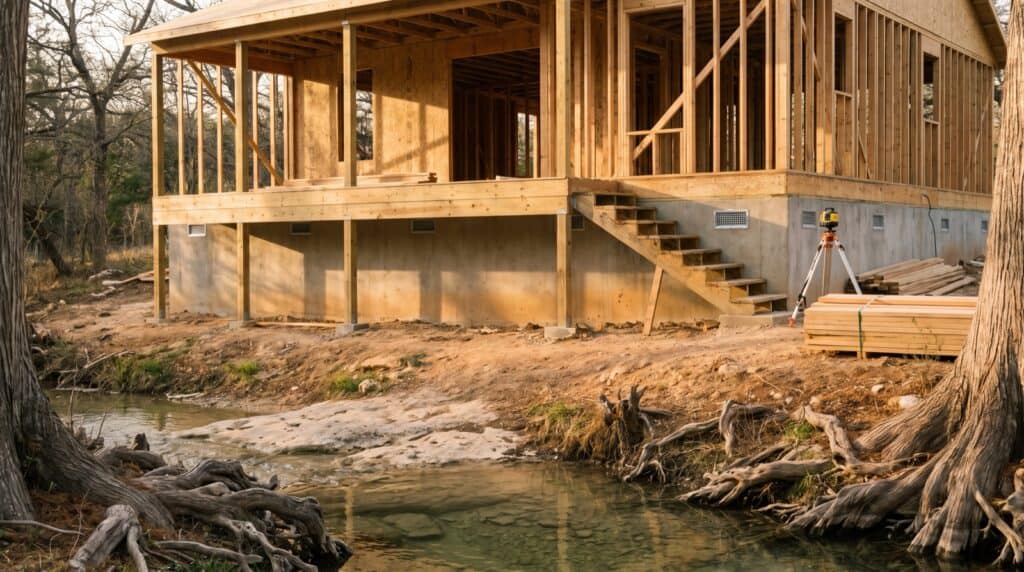
Space below the lowest floor is allowed, with limits. Hays County lets a fully enclosed area under an elevated home be used only for parking, building access, or storage. The walls need flood openings that let water in and out. The minimum is two openings on separate walls, with one square inch of opening for every square foot of enclosed area, unless an engineer or architect certifies another design.
All of this shapes the house itself: foundation type, stair runs, driveway grade, and how the home meets the ground. If you are building a home in Wimberley near either creek, we design those pieces around the required floor height from the first sketch. On the job, our layout crew sets finished-floor and pad heights from an established benchmark, the same elevation control we describe in our guide to construction staking on a steep lot. One caveat: Hays County is rewriting its development regulations, so confirm the standard in force when you apply.
Elevation certificates from plan to final
FEMA says a community’s permit file must show that new buildings and substantial improvements in the hazard area are properly elevated. The standard record is the Elevation Certificate, and FEMA’s instructions for the form say its certification section may be signed only by a land surveyor, engineer, or architect authorized by state law. That is not builder work, and Iron C Construction does not do it. We schedule it.
In Hays County, the elevations show up twice. At application, the permit needs the elevation of the site and of the proposed lowest floor, certified by an authorized Texas professional. After the lowest floor is placed, the permit holder submits a certification of the as-built elevation. For a finished-construction certificate, FEMA’s 2023 guidance requires at least two photos of the building, four when possible, taken within 90 days of certification.
The certificate pays off later, too. FEMA notes you do not need one to buy flood insurance, but if you provide one, FEMA considers it when it rates the policy. A home built well above the line has the paperwork to show it.
Does a remodel or addition trigger the 50 percent rule?
It can, and it matters most for older homes along the Blanco River. Under Hays County’s rules and FEMA’s definition, a substantial improvement is any rebuild, addition, or other improvement that costs 50 percent or more of the structure’s market value before the work starts. Once a project crosses that line, Hays County applies the same rule it uses for new homes: the lowest floor has to sit 2 feet above the base flood elevation.
The same rule applies after a flood. Damage that would cost 50 percent or more of the market value to repair counts as substantial damage. FEMA’s guidance also says a lateral addition that changes the building’s certified information needs a new Elevation Certificate, even when the project stays under 50 percent. If you are weighing a remodel against a rebuild on a creekside lot, run this math before the design gets far.
What the 2015 Blanco River flood changed
Anyone building near the Blanco River in Wimberley should know what happened over Memorial Day weekend in 2015. The National Weather Service recorded the Blanco River at Wimberley rising from about 5 feet at 9 p.m. to about 41 feet by 1 a.m. Between 10:45 and 11:45 that night, the river rose 5 feet every 15 minutes. It went from below flood stage to major flood stage in 45 minutes.
NPR reported that at least 12 people were killed and hundreds of structures were damaged or destroyed. The flood is the clearest local case for treating mapped elevations as a minimum. It is also a reminder of how the rules work. As the Texas Tribune has reported, Texas counties have no power to adopt comprehensive zoning that could keep people off the water’s edge. Most floodplain management rules flow from the National Flood Insurance Program instead. The county permit controls how you build in the floodplain. Whether a creekside site is a smart place for your home is still your call, and ours to talk through honestly.
Check the current and preliminary Hays County flood maps
Flood maps in Central Texas change. The Hays County floodplain page quotes FEMA’s warning that fast-growing communities can create a floodplain where none existed before. In March 2025, FEMA released preliminary flood insurance rate maps for unincorporated Hays County and several cities, and the appeal and comment period ran from October 29, 2025, to January 27, 2026. FEMA sets the effective date after appeals are resolved. The City of Wimberley’s FEMA page also notes that preliminary maps have been released for public review.
Check both the effective map and any preliminary map for your parcel on the FEMA Map Service Center, then confirm with the floodplain administrator for your jurisdiction. Hays County notes that some lenders may require flood insurance before new maps take effect. If you are still shopping for land, put the map check near the top of your list, as we explain in our guide to buying Hill Country land to build on.
How Iron C Construction plans a creekside build in Wimberley
Iron C Construction has built in Wimberley since Robert Castro founded the company here in 2020, and our Construction Coordinator, Arthur Leyva, brings more than 20 years in construction. On a Hill Country property near the Blanco River or Cypress Creek, we work in this order:
- Pull the effective and preliminary flood maps and confirm whether the city or the county reviews the permit.
- Request the floodplain determination or base flood elevation so the design starts from a real number.
- Site the house out of the floodway, and out of the hazard area entirely when the lot allows it.
- Set floor and equipment heights with the freeboard built in, then plan the foundation, stairs, and driveway around them.
- Bring in a licensed surveyor or engineer for the certified elevations at application and after the floor is placed.
We handle construction layout, coordination, and the build. Licensed surveying and stamped engineering stay with the licensed professionals, and we line up their work so the permit file is complete.
If you own land near the creeks or are weighing a lot that touches the floodplain, we can walk it with you and tell you plainly what the map allows. As a custom home builder in Wimberley, we would rather settle the flood question before design than after it. Bring your survey or parcel number, and we will start there.